Tropical Storms
In the Western Pacific:
Tropical Storm Trami is expected to strengthen to a typhoon Wednesday, as it continues a brisk west-northwest track.
On this track, Trami's centre will track pass near or over northern Taiwan, including its capital, Taipei, on Wednesday. Most likely, Trami will be a Category 1 equivalent typhoon by that time.
From there, Trami will track toward southeast China by early Thursday, most likely remaining well south of Shanghai and north of Hong Kong.
Some surge flooding is expected along Taiwan's east coast as Trami approaches, and damaging winds will also be a threat, particularly over Taiwan's higher elevations.
The most serious threat from Trami may be from additional flash flooding and mudslides.

In the Central Pacific:
Two storms, Pewa and Unala, formed in the central Pacific and moved into the western Pacific. The former has become a typhoon but is way out at sea between Hawaii and the Philippines and its core will pass well northeast of Wake Island; the latter has dissipated and the final advisory on it has been issued.
Floods in the Philippines:
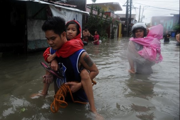
Flooding caused by some of the Philippines' heaviest rains on record submerged more than half the capital Tuesday, turning roads into rivers and trapping tens of thousands of people in homes and shelters. The government suspended all work except rescues and disaster response for a second day.

Throughout the sprawling, low-lying capital region of 12 million people, floodwaters made most of the roads impassable and reached waist- or neck-deep along rivers and creeks. Authorities opened more than 200 evacuation centers in Manila and surrounding provinces filled with tens of thousands of people, Social Welfare Secretary Corazon Soliman said. Overall, more than 600,000 people have been affected by the floods.
NewsBytes:
A tornado swept through a children's camp in Baden-Wurttemberg in Germany, injuring 27 child campers and staff.
No comments:
Post a Comment