Tropical Storms - Roundup of Tropical Storms:

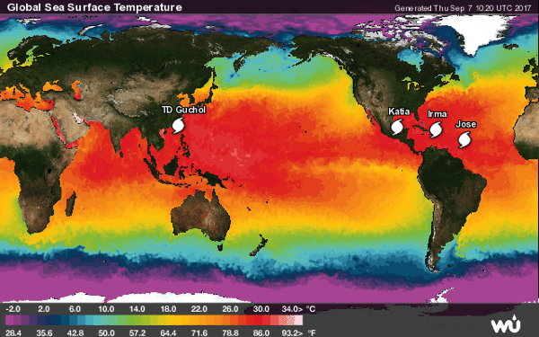
In the North Atlantic Ocean: Hurricane Irma is located about 95 mi...155 km N of Punta Cana Dominican Republic and about 210 mi...335 km eESE of Grand Turk Island with maximum sustained winds...180 mph...285 km/h. Present movement…WNW or 290 degrees at 17 mph...28 km/h.
Hurricane Jose is located about 815 mi…1310 km E of the lesser Antilles with maximum sustained winds…90 mph…150 km/h. Present movement…WNW or 285 degrees at 18 mph…30 km/h.
Hurricane Katia is located about 225 mi…360 km ESE of Tampico Mexico with maximum sustained winds…80 mph…130 km/h. Present movement…stationary.
In the Western Pacific: Tropical depression 19w (Guchol), located approximately 212 nm southwest of Taipei, Taiwan, is tracking north-northwestward at 08 knots.
Newsbytes:
Caribbean - Hurricane Irma lashed Puerto Rico with heavy rain and powerful winds Wednesday night, leaving nearly 900 000 people without power as authorities struggled to get aid to small Caribbean islands already devastated by the historic storm. Florida rushed to prepare for a possible direct hit on the Miami area by the Category 5 storm with potentially catastrophic 185 mph winds. Nearly every building on the island of Barbuda was damaged when the eye of the storm passed almost directly overhead early Wednesday and about 60 percent of the island's roughly 1 400 people were left homeless. As the storm moved west, it tore up the small islands in its path, the lush islands in tatters, with many of the homes damaged and the once-dense vegetation largely gone.
No comments:
Post a Comment