Tropical Storms - Roundup of Tropical Storms:

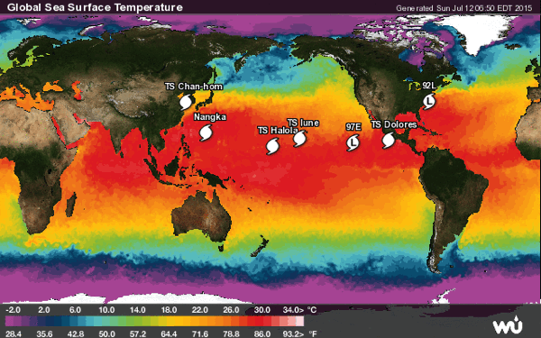
Tropical Storm 09w (Chan-Hom), located approximately 136 nm west-southwest of Kunsan AB, is tracking north-northeast at 18 knots.
Typhoon 11w (Nangka), located approximately 428 nm south-southwest of Iwo To, is tracking west-northwestward at 02 knots.
Tropical Storm Halola is located about 1115 mi...1790 km se of Wake Island and about 675 mi...1085 km WSW of Johnston Island with maximum sustained winds...60 mph...95 km/h. Present movement...WNW or 300 degrees at 12 mph...19 km/h.
Tropical Storm Dolores is located about 180 mi...285 km SSW of Acapulco Mexico and about 215 mi...350 km S of Zihuatanejo Mexico with maximum sustained winds...50 mph...85 km/h. Present movement...WNW or 300 degrees at 12 mph...19 km/h.
Tropical Storm Lune is located about 455 mi...735 km S of Lihue Hawaii and about 645 mi...1035 km E of Johnston Island with maximum sustained winds...40 mph...65 km/h. Present movement...WNW or 295 degrees at 12 mph...19 km/h.
Invest 97E is an area of disturbed weather in the East Pacific which has the potential for tropical development.
Invest 92L is an area of disturbed weather in the North Atlantic which has the potential for tropical development.
NewsBytes:
India - At least 14 villages in the districts of Sundergarh and Jharsuguda were inundated by floods on Saturday due to depression-induced heavy rainfall. The rain also caused landslides and destroyed crops on farmland in the area.
No comments:
Post a Comment